Cedar Breaks National Monument…
It Will Take Your Breath Away.
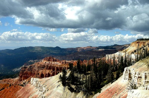
Photo: Wikimedia Commons - Richard Ellis
Cedar Breaks National Monument, sitting high atop the Markagunt Plateau at over 10,000 feet above sea level, can, for those unaccustomed to the altitude, literally take your breath away.
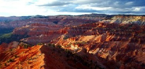
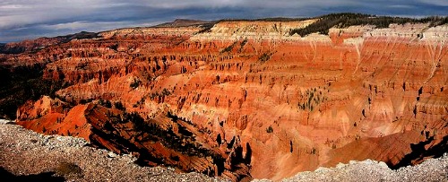
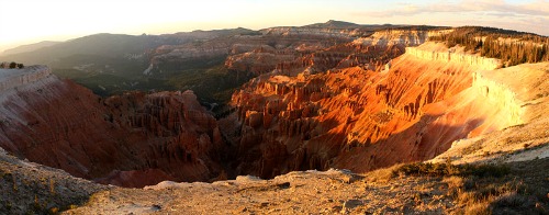
At the Point Supreme Overlook, the elevation is 10,350 feet above sea level, and as you look out over this vast amphitheater the view is truly breathtakingly beautiful.
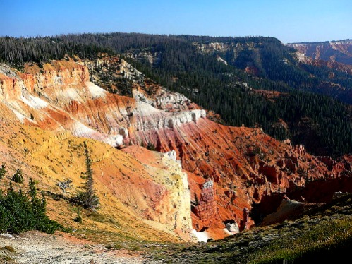
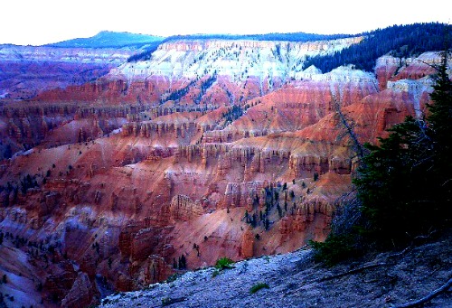
The amphitheater is 3 miles wide, 2,500 feet deep and replete with coral pink and white pinnacles, ridges, hoodoos, spires, arches and buttresses.
The Southern Paiutes who have occupied this area for a number of years describe it in a number of ways, two of which are a “Circle of Painted Cliffs,” and “the place where the rocks are sliding down all the time”.
Early settlers to the area gave the area its name when they mistakenly thought the nearby twisted Utah junipers were cedar. They used Breaks because of its abrupt, broken, and deeply eroded canyon. Thus Cedar Breaks.
|
Quick Facts About Cedar Breaks National Monument • It is the second highest National Monument in Utah |
Photo: Courtesy Wikimedia Commons - Dcjsr 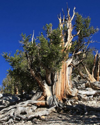 |
|
Location Cedar Breaks National Monument is located in the southwestern part of Utah, approximately 23.6 southeast of Cedar City and 6 miles south of Brain’s Head, Utah. |
Books and Maps about Cedar Breaks National Monument may be purchased at the Visitor Center or at Amazon.com by clicking the link below. |
Operating Hours and Seasons
Summer Season
For those of you who are not into winter sports and activities, your time at the Monument is pretty much limited to the summer season which runs from late May through mid-October.
During that time, the Visitor Center and restrooms are open daily from 9:00 AM to 6:00 PM.
The Scenic Drive, Utah Highway 148, is open from late May until the first heavy snowfall, usually in mid-November
Point Supreme Campground
Open mid-June - late September
Photo: Courtesy National Park Service - Unknown NPS Photographer
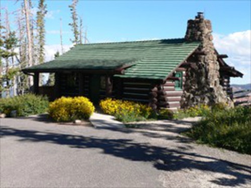
Visitor Center at Point Supreme
The Visitor Center was built in 1937 by a crew from the Civilian Conservation Corps (CCC's) and was used as a museum and office until the Cedar Breaks Lodge was torn down in 1972.
It is listed under the National Register of Historic Places.
Hours
The visitor center is open daily from early-June until mid-October, depending on the weather and road conditions.
The hours are from 9:00 AM until 6:00 PM.
There is a bookstore, operated by the Zion Natural History Association, located within the Visitor Center.
Restrooms are located at the parking lot near the fee booth.
Photo: Courtesy National Park Service - Unknown NPS Photographer
Fees
• $4 Per Person age 16 or older (Children 15 and under are free)
• Valid for seven days.
• This fee is paid at the entrance station at Point Supreme.
Weather & Climate
Temperatures in the summer months tend to stay in the 60s and 70s during the day, but fall to the 30s and 40s at night.
Cedar Breaks National Monument can get about 250 days of freezing temperatures during the year and over 15 feet of snow during the winter months.
Have A Great Story To Share?
Do you have a great story about this destination? Share it!
Lodging
The Cedar Breaks Lodge was built in 1924 and was demolished in 1972 because it was not deemed profitable due to the short season.
|
Unfortunately another lodge was never built to replace it, so the only lodging available is in the nearby towns of Brian Head, (2 miles north of the park), and Cedar City, (22 miles to the south of the park). To find lodging in either of these places, use the Search Box to the right. |
Simply enter the location and dates you have in mind, and the server, Hotels Combined, will provide you with a list of the lodging available on the dates you have specified.
This is not a booking agency. It is a search engine to help you find great lodging at great prices.
Camping
Point Supreme Campground
Camping is available from mid-June to mid-September.
Fees
Fee are paid at the self-pay station at the entrance to the campground or when reserving a site at www.recreation.gov .
• $14 Per Night
• $7 Per Night with a Senior Pass or Access Pass
Photo: Wikimedia Commons - Bob Palin
Capacity and Reservations
• 28 Campsites - Accomodates both tents and RVs
o Ten sites are available for reservation
- Eight RV/tent sites
- Two tents only sites
- 18 sites are available on a first-come, first-served basis.
• Each campsite has a picnic table and fire pit.
• There are also restrooms with showers, chopped firewood, and water spigots.
Sidebar
Campground opening and closing dates may be slightly earlier or later and is subject to favorable weather.
Camping is NOT permitted in parking lots or at overlooks.
Fires are permitted only in the fire grates when there are no fire restrictions within the area. Firewood collecting is not permitted.
For further information on camping, Click Here.
Photo: Wikimedia Commons - LeavXC
Pets
The policies regarding pets at the Monument are quite strict:
• Pets must be kept on leash at all times
• Leash must not exceed six feet in length
• Pets are not allowed in the Visitor Center
• Pets are not allowed on any trail except the Campground trail that leads to the Visitor Center.
• Pets are allowed in the Campground as long as they are on a leash which is no longer than 6 feet in length
• Pets are also allowed on all paved areas, including all of the overlooks located throughout the Monument. Again, they must be on a leash.
• Service Animals are allowed on all of Cedar Breaks' trails and buildings and must be clearly identified as such.
|
While visiting Cedar Breaks National Monument, you might want to consider boarding your pet or leaving it with a pet sitter. For more information on nearby kennels and pet sitters, Click Here. |
 |
 |
Click Here for more information concerning the pet policy at Cedar Breaks. |
|
Nearby Attractions • Bryce Canyon National Park |
Things to Do
Cedar Breaks Scenic Drive (Utah Highway 148)
Open from late May until the first heavy snowfall, usually in mid-November.
A six mile drive through meadows and forests with four panoramic overlooks.
Interpretive Programs
The park has a variety of interpretative programs, from Ranger talks to guided hikes to evening campground programs.
To learn more about the Ranger-led programs, Click Here.
For anyone interested in learning more about the night sky, there are several “Star Parties” scattered throughout the summer season.
For more information, Click Here.
Photo: Wikimedia Commons - Marc Averette
Hiking
Bikes and motorized vehicles are not allowed on any of the hiking trails located within the monument. Pets are only permitted on the Campground Trail.
There are three easy hikes within the park: Campground Trail, Spectra Point/Rampart Overlook Trail and the Alpine Pond Nature Trail.
Campground Trail
This is the only trail in the park on which pets are allowed as long as they are on a leash no longer than 6 feet in length.
The trail starts at the Visitor Center and ends at the Campground.
It is a nice one-mile round-trip hike with views of the “Breaks.”
Photo: Wikimedia Commons - Bob Palin
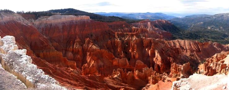
Spectra Point/Rampart Overlook Trail
Begins at the visitor center, then follows along the south rim approximately one mile to the Spectra Point Overlook.
The oldest bristlecone pine at Cedar Breaks, 1,600 years old, is found at Spectra Point.
If you continue along this trail, it is another mile to the Rampart Overlook, making it a four mile round trip.
This is a moderately strenuous trail.
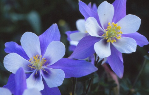
Colorado Blue Columbine
Alpine Pond Nature Trail
You can access this trail from either the Chessman Ridge Overlook or from another trailhead 1.1 mile north along the Scenic Drive (Utah highway 148).
It is a two-mile double-loop trail through forest and meadows.
The upper loop takes you through lush meadows of grasses and wildflowers whereas the lower trail offers views of the amphitheater.
Half way between the two loops is Alpine Pond, a beautiful spring-fed pond, where you can sit and relax before either continuing on or turning back.
The Alpine Pond is easy to moderate in difficulty.
Rattlesnake Creek Trail
This is a USFS unmaintained trail. The upper trailhead is located just outside the park’s north entrance.
The trail continues downhill, ending at Highway 14 in Cedar Canyon where Ashdown and Crow creeks join to become Coal Creek
This is a rugged 11 mile hike with poor or non-existent trail markers and should be attempted only by hikers who are well versed in map reading.
For more on this trail, Click Here.
|
Indian Paintbrush 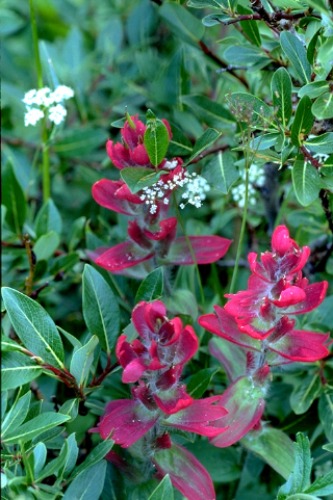 |
Wildflower Photography At over 10,000 feet in elevation, spring and summer come late to the "Breaks." Early bloomers like mountain kittentails and aspen bluebells are often flowering while there is still snow on the ground. By mid-July, the meadows and forest glades are filled with such a profusion of wildflowers as to enamor even the most jaded enthusiast. For the last six years, Cedar Breaks has showcased nature's bonanza with a Wildflower Festival, a fortnight given over to the celebration of wildflowers. For more about the festival, Click Here. |
|
Over 150 species of wildflowers have been recorded at the Monument. Some of the ones you may expect to see are: • Marsh Marigold |
Colorado Blue Columbine 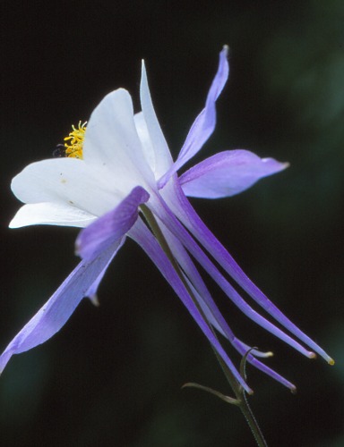 |
Winter Season
From mid-October until late May of the following year, the park becomes a Winter-Wonderland.
It can get over 15 feet of snow during the winter months.
Once there is adequate snow depth, usually from late October to early December, the park is open to cross-country skiing, snowshoeing and snowmobiling.
Sidebar
Scenic Drive, Utah Highway 148, is closed after the first heavy snowfall, usually mid-November.
The Visitor Center and restrooms are closed.
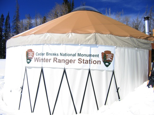 |
Once Utah Highway 148 closes, depending on the snowfall, the Winter Ranger Station, located 1 mile south of the junction of UT-143 and UT-148, is open from 11:00 AM until 2:00 PM on Saturday and Sunday. Point Supreme Campground: Closed |
For more information about the winter ranger station, go to www.nps.gov.
Call (435) 586-9451 or (435) 586-0787 for more details and to confirm opening and closing dates.
History
From stone tools found in the area of Brian Head, we know that there has been a human presence in and around this area for hundreds of years.
The Southern Paiute, who lived and farmed along the creek and river valleys below, escaped the summer heat by hunting deer, elk, rabbits and bighorn sheep in the these mountains.
In the mid-1850s, Mormon dairy farmers used the alpine meadows around Brian Head and Cedar Breaks to graze their cattle.
In the 1920s, Minnie Adams, the daughter of a prominent cattle and sheep rancher, converted a wooden building her father had constructed into a summer lodge.
The lodge, located at the northern end of what is now Cedar Breaks, became known as Minnie’s Mansion, and the local inhabitants “flocked to the high country to watch fireworks, eat home-cooked food, and dance the night away.” 1
The seasons, however, were too short to be profitable, and within five years Minnie’s Mansion was abandoned and today only a trace of its foundation remains.
Photo: Courtesy Wikimedia Commons - Marc Averette
Contact Information
Cedar Breaks National Monument
2390 W. HWY 56, Suite 11
Cedar City, UT 84720
(435) 586-0787 Monument Phone (mid-June--mid-October)
(435) 586-9451 Administrative Office Phone
(435) 586-3813 Fax
References and Resources
1 Nicky Leach, Cedar Break National Monument. Utah, Paragon Press, 1994
National Park Service
http://www.nps.gov/cebr/index.htm
Rocky Mountain Magazine
http://www.rockymountainmagazine.com/national-parks/cedar-breaks-national-monument/
Utah.com
http://www.utah.com/snowmobile/cedar_mtn.htm
Moon Travel Guides
http://moon.com/
Wikimedia Commons
http://commons.wikimedia.org/wiki/File:Big_bristlecone_pine_Pinus_longaeva.jpg
Return From Cedar Breaks National Monument To Nearby Attractions
Return To Lake Powell Country and The Grand Circle Home Page

